





 Monday, 12-10-26








Why This Bilateral Space Push Matters
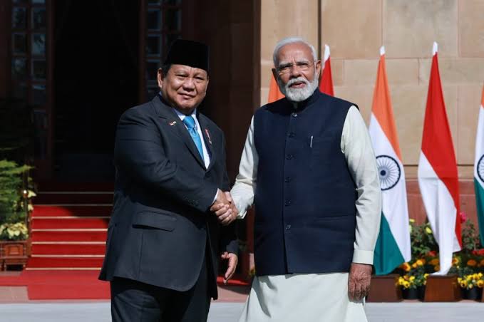
Indonesia and India are turning space cooperation into a practical strategic agenda, not just a diplomatic talking point. During Prime Minister Narendra Modi’s state visit to Jakarta on July 7, 2026, the two countries signed or announced 16 cooperation agreements covering space, defense, healthcare, agriculture, technology, education, and other sectors. ANTARA reported that the agreements included expanded cooperation on space exploration, telecommunications, agriculture, and research, technology and innovation. The Ministry of External Affairs also confirmed that the visit produced a joint statement spanning multiple sectors.
That matters because the latest Indonesia India space cooperation agenda is no longer limited to symbolic exchanges or broad statements about partnership. The reported priorities now include satellite development, food security, environmental monitoring, and aviation applications. BRIN chief Arif Satria said Indonesia already collaborates with ISRO through the Biak ground station and is preparing to launch a BRIN built satellite in India in January 2027. He also said the satellite will support food security and environmental monitoring.
BRIN, ISRO, And The Biak Link
The Biak connection is one of the clearest examples of how space cooperation between the two countries has moved from theory to infrastructure. ISRO’s own Telemetry, Tracking and Command Network says it has established a ground station in Biak, Indonesia, as part of its wider network for mission operations, tracking, and satellite support. The same page says the network also supports disaster management services and space based applications such as telemedicine and tele-education.
This is important for two reasons. First, it shows that the technical relationship already exists and is operational. Second, it shows that the cooperation is not only about launching satellites, but also about running them, tracking them, and using their data for practical purposes. That makes the current bilateral push more credible, because it builds on an existing architecture rather than starting from scratch.
Indonesia has also been active in wider international space collaboration. ISRO’s international cooperation materials say the agency works with both space-faring and space-aspiring countries and that major areas of cooperation include joint satellite missions, ground stations, data sharing, and disaster management. In that context, Indonesia fits naturally into India’s broader space diplomacy framework.
How Satellites Can Help Food Security And Airports
The most striking part of the new agenda is the combination of food security and airports in one conversation. That is not as unusual as it sounds. Satellites are already used for remote sensing, weather observation, crop monitoring, and mapping, all of which directly affect agricultural planning and resilience. BRIN has previously said satellite data can be used for disaster monitoring, forest fires, fisheries, oil spills, illegal fishing, and forest coverage, which shows how broad the policy value of satellite systems can be.
For food security, the logic is straightforward. Satellite imagery helps governments and researchers assess land use, monitor crop health, track irrigation needs, and spot environmental stress early. When Arif Satria said the BRIN satellite will support food security, he was pointing to a real operational use case, not a vague aspiration. The same satellite can also support environmental monitoring, which matters for Indonesia’s agriculture, disaster risk, and long term climate resilience.
The airport angle also has a strong technical basis. India’s GAGAN system, the GPS Aided GEO Augmented Navigation platform developed by ISRO and the Airports Authority of India, is a satellite based augmentation system certified for aviation use. Official AAI materials say GAGAN allows GPS to be used as an aviation navigation system from take off through near Category I precision approach. That is a concrete example of how satellites can improve airport safety, approach procedures, and navigation reliability.
So when Indonesia and India talk about satellites in the same breath as food security and airports, the agenda is broader than launching hardware. It points toward a dual use model in which satellite systems support agricultural planning on one side and aviation navigation on the other. That is a smart framing for a country like Indonesia, where geography, logistics, and food supply chains all depend on reliable spatial data. This is an inference from the reported priorities and the established uses of satellite systems, but it fits the evidence well.
What The New Agreements Signal For Industry
The new round of agreements suggests that space cooperation is being integrated into a larger economic and industrial partnership. ANTARA said the package covered space exploration, telecommunications, agriculture, pharmaceutical regulation, research, technology, and innovation. That means the space agenda is not isolated from the rest of the bilateral relationship. It sits inside a wider framework of economic modernization and strategic alignment.
This also matters for the private sector. ISRO’s BRICS cooperation documents from June 2026 emphasize remote sensing satellite constellations, space sustainability, launch services, satellite technologies, geospatial intelligence, and downstream applications. In other words, the institutional language around space is already pointing toward commercial and civilian service ecosystems, not only government missions.
For Indonesia, that creates room for domestic institutions and companies to participate more actively. BRIN is moving toward its own satellite launch in India in early 2027, and that could help strengthen local expertise in payload development, mission planning, data analysis, and downstream applications. If those capabilities mature, the country can use space cooperation not just to import know how, but to build a deeper national ecosystem around remote sensing and aviation support.
The Bigger Strategic Picture For Indonesia And India
The timing of the announcement is also significant. India and Indonesia are deepening cooperation at a moment when both countries are trying to expand strategic autonomy, strengthen resilience, and diversify their technology partnerships. The joint statement from the Indian foreign ministry confirms that space cooperation sits alongside defense, economic, and innovation priorities in the broader state visit outcomes.
India’s broader space diplomacy strategy reinforces this direction. ISRO’s cooperation pages say international partnerships help enhance capability, strengthen diplomatic relations, and formulate global guidelines on space. The same materials note that India operates ground stations in Indonesia and several other countries. That gives India a concrete basis for being a technology partner, not just a political interlocutor.
For Indonesia, the gains are equally clear. Better space cooperation can support food security, improve environmental surveillance, enhance airport navigation, and deepen disaster preparedness. The country’s digital and scientific agenda has been moving toward more data driven governance, and satellite systems fit naturally into that shift. Reuters reported in June 2026 that Indonesia is already planning to embed AI in key government programs, including its free meals drive, which shows how seriously the administration is treating technology as an operational tool. Satellite data can strengthen that same policy direction.
There is also a regional signal here. India, through BRICS and bilateral channels, is presenting itself as a space partner that can help other countries build capacity in remote sensing, navigation, and satellite services. Indonesia, by engaging at this level, is signaling that it wants to be more than a consumer of imported space data. It wants to shape a domestic system that supports agriculture, aviation, and national resilience. That is the real story behind this space cooperation push.
The latest Indonesia India space cooperation agenda is best understood as an infrastructure story. It is about building systems that can support food security, environmental monitoring, and airport operations while also strengthening bilateral trust. The Biak ground station, the planned BRIN satellite launch in India, and the wider set of signed agreements all point in the same direction. This is a practical partnership with clear technical and policy use cases, not a ceremonial one. If the two governments keep moving at this pace, space cooperation could become one of the most productive pillars in the relationship.
Read More